GeoSense ✅NADIR Images and Oblique Images in Remote SensingWhat is the difference between NADIR Images and Oblique Images?May 6, 2023May 6, 2023
GeoSense ✅Calculate the Normalised Burn Ratio (NBR) using Landsat 8 remote sensing data in PythonCalculate the Normalised Burn Ratio (NBR) using Landsat 8.May 10, 20231May 10, 20231
InGeoinfomaticsbyGeoSense ✅Using Google Earth Engine (GEE), utilise the Sentinel-2 imagery to generate the Enhanced Vegetation…EVI from Sentinel-2 image on GEEJul 13, 20231Jul 13, 20231
In𝐀𝐈 𝐦𝐨𝐧𝐤𝐬.𝐢𝐨byGeoSense ✅Create object masks from input prompts with SAMIn this notebook, you will learn how to create object masks from input prompts using the Segment Anything Model (SAM).Jun 3, 20231Jun 3, 20231
GeoSense ✅Self-Organizing Maps for Sentinel 2 Image Segmentation using PythonA step-by-step guide to segmenting a Sentinel-2 image using Self-Organizing Maps (SOM) in PythonApr 29, 20231Apr 29, 20231
In𝐀𝐈 𝐦𝐨𝐧𝐤𝐬.𝐢𝐨byGeoSense ✅Use Segment Anything Model (SAM) for Geospatial DataSAM for Geospatial DataMay 11, 20234May 11, 20234
GeoSense ✅Understanding Soil Indices from Multispectral Imagery and their Formulas and Functions in Python…Learn about common soil indices used in remote sensing and how to implement them in popular programming languages.Apr 9, 20231Apr 9, 20231
GeoSense ✅Geemap: Find the greenest day of the year by locationHow to find the greenest day of the year by location?Apr 11, 2023Apr 11, 2023
GeoSense ✅Capabilities of Apple M1/M2 Chip for GIS and Geospatial DevelopmentThe Apple M1/M2 chip is a powerful processor that can handle GIS and geospatial development tasks. It is capable of running software such…Apr 13, 2023Apr 13, 2023
GeoSense ✅How to Transform L1C to L2A from Sentinel-2 ImageryL1C (Level-1C) data from Sentinel-2 contains the raw data that has been radiometrically and geometrically corrected but is still in its…Apr 15, 20233Apr 15, 20233
GeoSense ✅What is NDVI in Remote Sensing Analysis?“Normalized Difference Vegetation Index (NDVI) quantifies vegetation by measuring the difference between near-infrared (which vegetation…Apr 15, 20231Apr 15, 20231
GeoSense ✅Computing NDVI from Sentinel 2 ImageryNDVI is a vegetation index that utilizes the contrast between near-infrared light (which is highly reflected by vegetation) and red light…Apr 18, 2023Apr 18, 2023
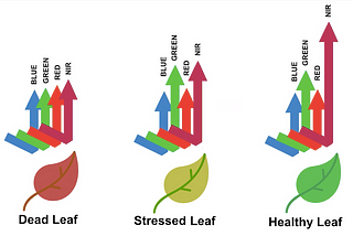
In𝐀𝐈 𝐦𝐨𝐧𝐤𝐬.𝐢𝐨byGeoSense ✅10 Common Vegetation Indices and Their Applications in Remote SensingVegetation indices are mathematical expressions that help to quantify the health, density, and vigor of vegetation from remote sensing…Mar 24, 20231Mar 24, 20231
In𝐀𝐈 𝐦𝐨𝐧𝐤𝐬.𝐢𝐨byGeoSense ✅Functions for 10 Vegetation Indices in Python, Matlab and R LanguagesThe functions provide the mathematical formulas for 10 common vegetation indices, implemented in Python, Matlab and R languages for data…Apr 9, 20231Apr 9, 20231
GeoSense ✅Chapter 3 — Clipping and Extracting Spatial DataLearning Objectives:Mar 6, 20231Mar 6, 20231
GeoSense ✅Chapter 2 — Practice Spatial Vector Data with GeoPandasGeoPandas library is to make working with spatial data in python easier that combining the capabilities of pandas and shapely, providing…Jan 6, 2023Jan 6, 2023
GeoSense ✅Chapter 1 — Spatial DataIn a GIS environment, objects or entities can be recorded in 2D or 3D space. These spatial entities can be represented as a vector data…Jan 4, 2023Jan 4, 2023